Territory, Imaginary, Ecology A Critical Cartography of the Sky
Introduction
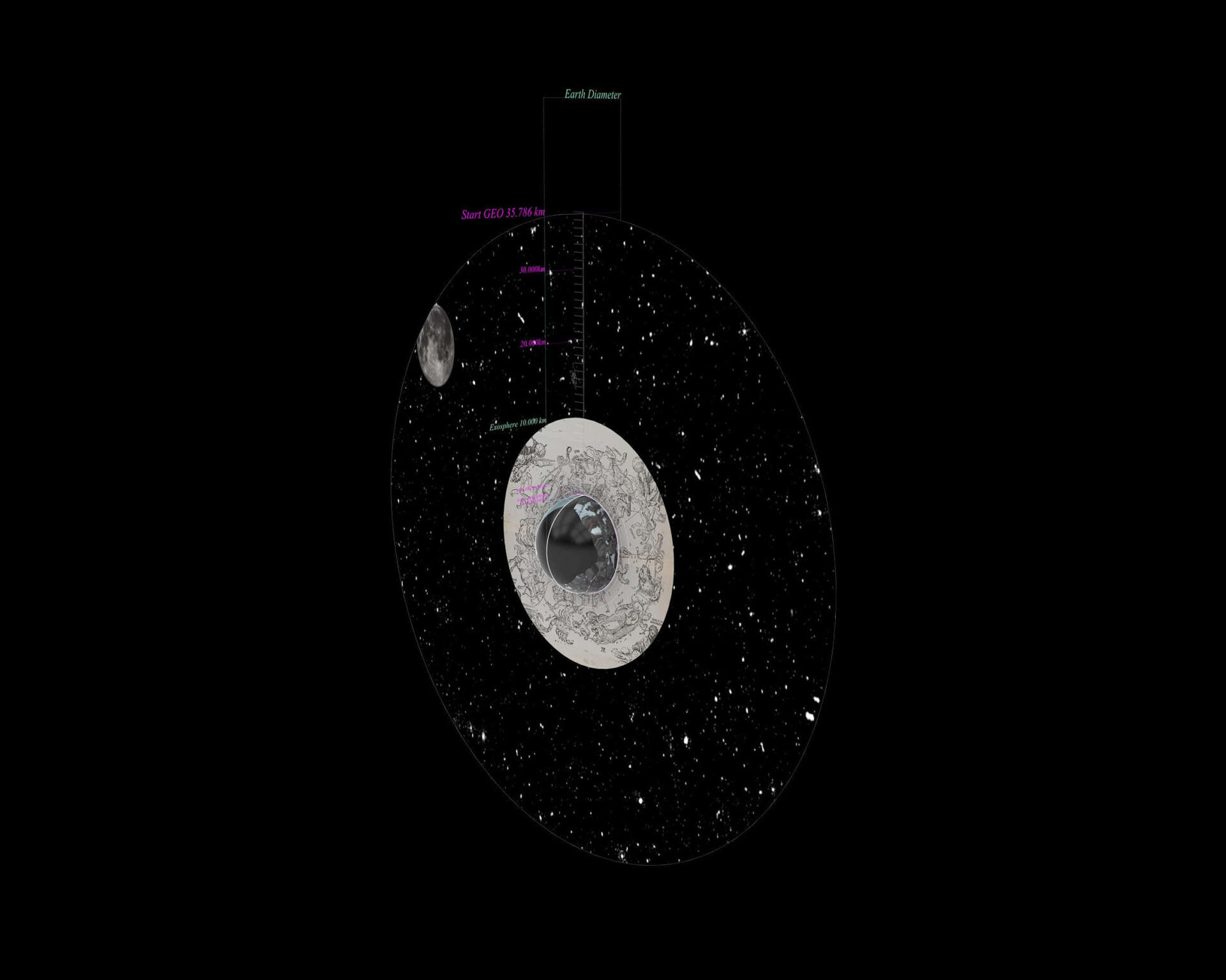
The atmosphere—part of Earth's interconnected system comprising the geosphere, biosphere, cryosphere, and hydrosphere—has only recently become accessible through the development of advanced technological infrastructures. The emergence of the manmade Technosphere resulting in the Anthropocene has transformed the sky from a metaphorical space of aspiration into a contested geopolitical territory that can be actively designed, commodified and divided. Vacillating between atmosphere and sky, urban territory and social field of imagination, the atmosphere offers the unique quality of being both metaphor and territory simultaneously, a co-presence that contemporary datafication of sky media renders illegible (Tsing, 2012; Kurgan, 2013; May, 2017). (Fig.1)
Therefore, the project title names three lenses of research as analytical registers: ‘territory’, designates the atmosphere as contested, governed and operational space (Parks, 2013; Adey, 2014; Vegetti, 2017; Barrio, 2023; Weizman, no date), ‘imaginary’means the cognitive spatial environment associated with the sky through symbolism, shape and place of aspiration, activated through sky platforms, infrastructures and images, together referred to as sky media (Iwaniszewski, 2011; Peters, 2015; Callard, 2018), whereas ‘ecology’designates the media ecology of the sky as entangled field of infrastructures, media and spatial imaginaries, through which the sky is built and perceived. Following Sy Taffel’s notion of media ecologies as scalar entanglement, media ecologies are never neutral or factual but encode specific power relations between body, technology and territory (Taffel, 2013), rendering the imaginary and its territory entangled with each other.
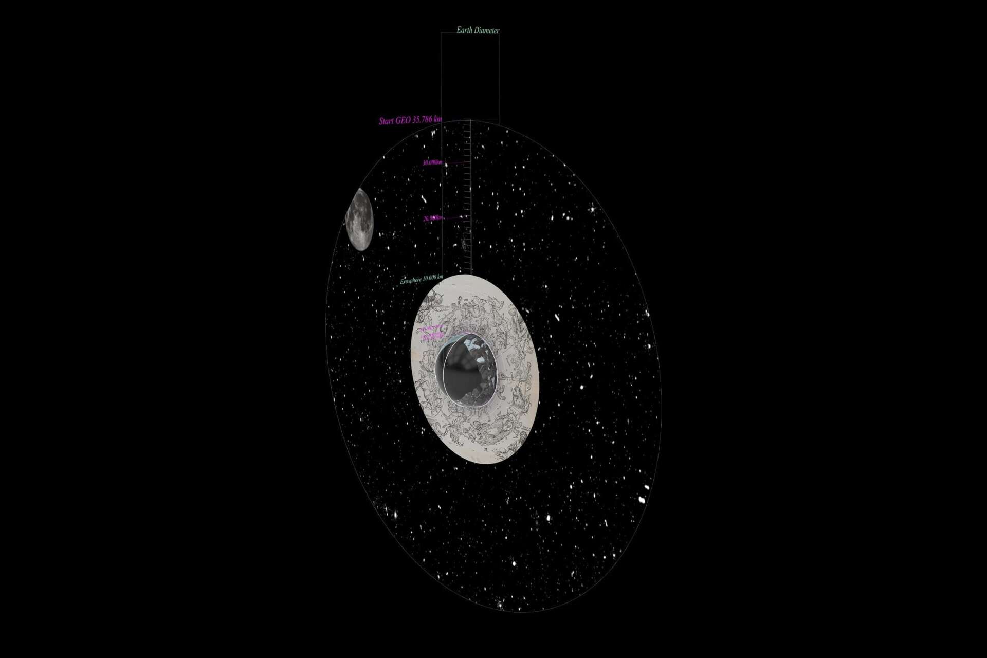
Figure 1: Sky Imaginary and Atmospheric Territory. Drawing by Alma Grossen, 2026.
State of the Art and Research Gap
Architecture, as a human-designed habitat, is always placed within a global outside, the atmosphere (Grosz, 2001; Brenner, 2017). This outside, the planet’s Umwelt, is one shared global monospace of very large size (Adey, 2014). As an architectural object it becomes part of the classical typologies and has a domestic quality: it is home, not just in the territorial, the garden, the city and the landscape, but also expands upwards, in a spherical vertical volume of inherently strange dimensions (Harman, 2011; Morton, 2013).
According to the state of the art, the sky as imaginary and territory can be understood through three theoretical lenses. First, as elemental media: a spatial field of cultural, symbolic and navigational meaning through representational systems and their respective scalar logic (Peters, 2015; Horn, 2018). Second, as a social field: a web of cultural concepts of the sky and atmosphere overlap and coincide, and values and meaning are ascribed to spatial qualities and sky objects (Iwaniszewski, 2011). Third, as a space of aspiration: a relational tension between what is projected conceptually and a designed planetary territory, an orientation towards a value not yet fully inhabited. This aspect has gained traction through the possibility of space travel and invention of airflight, peaking at moments of colonial discovery and technological progress. Within architecture, the exotization and othering of the sky is comparable in its semiotic meaning to remote or unknown lands in previous fieldguides, for example the European Grand Tour proposed by Le Corbusier and his peers (Avermaete and Sabatino, 2025), or R.E. Buckminster Fuller’s ‘Operating Manual for Spaceship Earth.’(R. Buckminster Fuller, 2008).
With the sky, a unique transformation has taken place, where the civilizational shift from imaginary to territory has produced different forms of encoding relationality. The overarching analytical instrument for this research is Erwin Panofsky’s principle of perspective as a symbolic form, where representational systems are a form of encoding cultural assumptions of the culture and society that produced them (Panofsky and Panofsky, 1991). The concept of the transscalar, understood as the simultaneous operation across multiple scales within one spatial field, is the three-dimensional pendent to the encoded relationality embedded in the sky (Brenner, 2001; Tsing, 2012; Taffel, 2013). Shannon Mattern has argued that infrastructure is equally an encoding system for epistemic and technical situations and never neutral (Mattern, 2017). Adding to this, John May’s thought on images, as communicators of systems of image production, makes clear that the pixelated surface is a product of the media ecology it was produced in (May, 201). When applying Anna Tsing’s concept of nonscalability to the sky, the aspect of scalability is set as a fallible system that misses the precise and nonscalable aspects of this territory that made the sky available to spatial practices before its navigability (Tsing, 2012). The atmosphere has gone through exactly this transformation and loss of readable meaning.
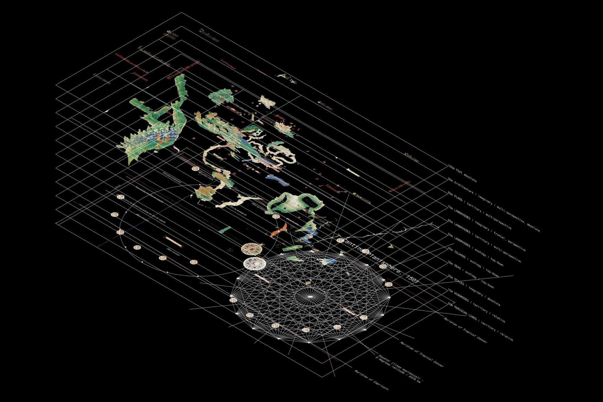
Figure 2: Cantino Planisphere, Encoded Relationalities. Drawing by Alma Grossen, 2026.
Situating these images within a coherent transscalar model, creates a critical cartography that gives a place to these practices and images - creating a critical field atlas, critical in the sense of counter-cartography (Haraway, 1988; Crampton and Krygier, 2015; May, 2017; Just, 2024): a way of mapping, that makes visible the scalar entanglements of the scalable, datafied atmosphere and the nonscalable, situated conditions they suppress, operating through analytical drawings of contemporary sky media, with historical precedents entering instrumentally, decoding the scalar logic of atmospheric datafication and making the relationship between territory and imaginary navigable and visible. Adding to this, Donna Haraway’s situated knowledges establish that all knowledge production is partial, making situated, embodied encounters with the sky a necessary counterpart to the totalized view of the atmosphere (Haraway, 1988). Together these works establish the atlas a s a legitimate research output, but do not address the sky as a transscalar field of encoded body-sky relationalities. (Fig. 2)
The existing literature establishes that sky representation encode relational logics between body, space and territory, but offers no spatial translation of this logic. Panofsky states perspective as a cultural encoding logic, but does not extend this principle transscalarly. Tsing’s concept of nonscalability identifies a relational condition, yet does not translate this into cartographic practice. Mattern points out the culturally encoded infrastructure systems, without offering a field guide. Durham Peters defines and analyses the sky as elemental medium, but does not show the scalar relationship between specific media objects. Kurgan demonstrates that spatial data technologies encode political meaning, but does not extend this argument transscalarly into a drawing method. My research situates itself at this gap, by developing a drawing method (Sky Inversion) translating these theoretical frameworks into a navigable spatial field (Hyperfield), producing together a critical cartography of the sky.
Methodology
This research develops a critical cartography through a practice of architectural decoding and spatial assembly of the sky as an inhabitable field, searching for encountering the sky as it appears within a bounded, inhabited, body-scaled spatial context, through the accumulation of Sky Inversions, analytical drawing operations that decode the encoded relationalities of contemporary sky media and producing scalar breaks making the co-presence between sky imaginary and atmospheric territory spatially legible. The research is located above Ghent and its connected atmosphere expanding over Belgium, while the sky media operate at a planetary scale. For this reason the model expands from the terrestrial crust to the Exosphere, and proposes spatial readings based on scales of 10, for each sky scalarity.
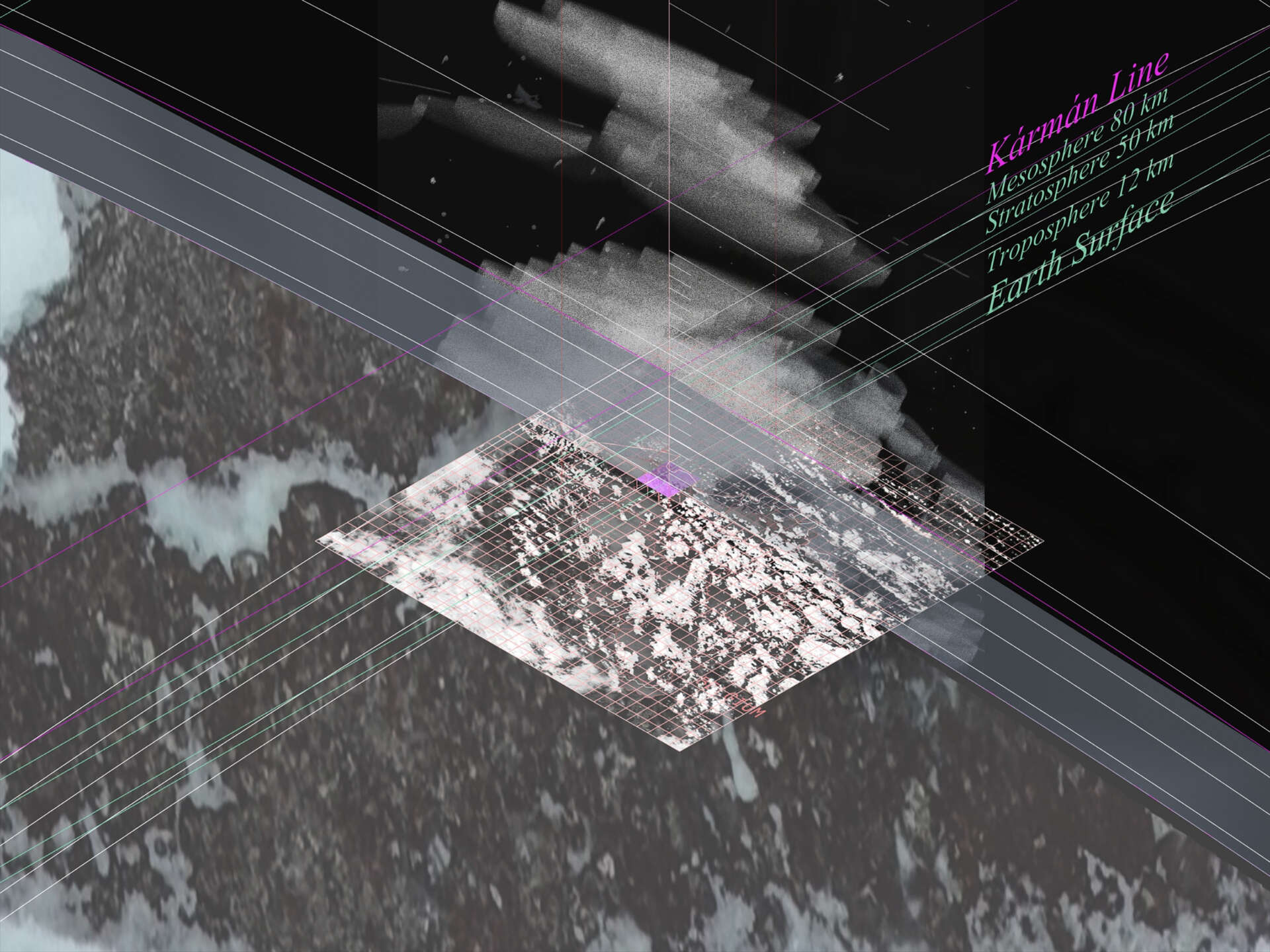
Figure 3: Hyperfield. 3-D Cartography by Alma Grossen, 2026.
Transscalar field modelling: The Hyperfield
The Hyperfield is built in Rhino and situates all Sky Inversions within one transscalar architectural container. This scalable, three-dimensional cartography is the primary spatial instrument of the research. The Hyperfield synthesizes Timothy Morton’s Hyperobject and Iwanizsewski’s Sky as Social Field into one transscalar architectural condition. (Iwaniszewski, 2011; Morton, 2013).
The Hyperfield holds territorial, imaginary and ecological registers simultaneously, making their tensions visible and navigable. The territorial register contains the decoded scalar logic of contemporary sky media, rendered as weightless, diagrammatic, scalable Rhino lines showing the atmosphere as totalizing, datafied, scalable and surveillant (Tsing, 2012; May, 2017; Barrio, 2023). The imaginary register relies on the decoded scalar logic of historical sky media and situated counter-practices, rendered as sketched, sensed, built, nonscalable environment. This is the sky form below as fragmented, situated, embodied and nonscalable (Haraway, 1988; Just, 2024).
The ecological register functions as layers where preexisting natural conditions are named and placed, opposing the territorial register, where satellites, governance layers and objects of the technosphere are placed.
The layer structure of the model corresponds with these conceptual registers of the project and is developed throughout the research process. When all registers are active simultaneously, their friction produces the critical cartography. (Fig. 3)
Analytical architectural drawing: Sky Inversions
Sky inversionsare analytical operations decoding the internal scalar logic of a contemporary sky medium, revealing the irreconcilable encoded relationalities within in. The drawing operation is analytical and not illustrative, revealing hidden architectural logic embedded in sky media. Dirven by a contemporary sky medium, its encoded spatial logic is drawn out a s a structural diagram situated within the Hyperfield, revealing hidden spatial logic embedded in the medium. In the first case study this principle is perspective as a symbolic form in Panofsky’s sense (Panofsky and Panofsky, 1991). This drawing operation produces a Scalar Break: a cognitive spatial event, in which holding both encoded relationalities simultaneously reveal their irreconcilability.
The principles selected constitute a coherent language of sky signifiers (viewports, air, dome, cloud, eclipse, glimmer, text, shadow, trace, horizon, rain), producing principles of encoded relationality (perspective, dome, enclosure, navigation, governance). Thinking of the body itself as part of the media ecology circuit, the scalar break becomes operative: it registers in the researcher’s and reader’s imaginary as the encoding systems coincide and the sky becomes briefly recognizable as an irreconcilable hyperobject. Historical precedents are not used comparatively, but instrumentally, as they enter as analytical resources by revealing their suppressed relational principle. They constitute the base for deriving a situated practice.
Method derivation: Situated Practice
Each scalar break generates a located situated practice, functioning as a method for producing the cognitive event of irreconcilable encoded relationality as a spatial experience for anyone who uses them. Each method makes the suppressed body-sky relation legible through architectural model building, legible beyond the researcher. Following Donna Haraway’s situated knowledges, each practice is partial, embodied and located, producing knowledge through diffraction rather than reflection (Haraway, 1988). Hand drawing is used as an instrument for counter-mapping, because its scalar resolution is not preset, but constructed through the drawing itself. Materiality, thickness, pressure, layering, pace are embedded by the moving line encoding the body’s situtated encounter with the sky in a way that no pixel-based medium can reproduce or scale (Ingold, 2008; May, 2017).
Drawing as a research instrument
This research does not use drawing as a tool of illustration, but rather as a form of analysis. Architectural drawing operations: sectioning, bordering, perspectival and optical projection, rendering make visible the spatial logic hidden within sky media.
When a finding is produced through drawing out a principle, the scalar breaks that arise, produce the methods for situated practices as reproducible analytical procedures. This research is not architectural, because it relates to the built environment, but because architectural instruments of drawing, make the unique spatial condition of the sky visible in ways that no other disciplinary method can offer. Hand drawing as a method for situated practice is inherently nonscalable, as the pace, materiality, value is embedded in the body that produces the drawing. Using at as a research practice bases on Tsing’s argument of nonscalability, as the drawing cannot be scaled without loss, fulfilling the condition of nonscalability.
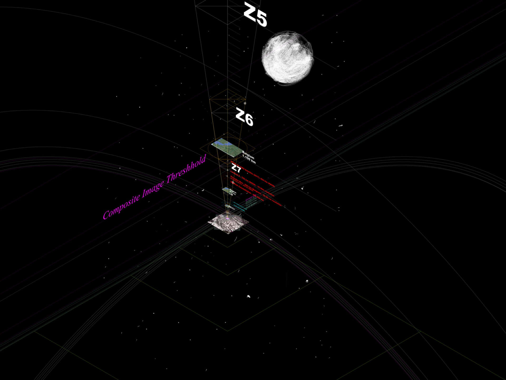
Figure 4: Google Image Zoom, Encoded Relationality. Drawing by Alma Grossen, 2026.
First Exemplary Sky Inversion: Zooming
The encoding of the sky through a cultural viewpoint, the symbolic perspective of Jan van Eyck’s folded altarpiece located in Ghent’s Sint Baafscathedral, situating the body within a nonscalable, non-hierarchical relational field, versus the orthographic post-perspectival Google Earth perspective encoding the atmosphere as scalable data surface, when zooming in on the Iphone, creates the first comparison of relational encoding principles. The Google Earth zoom sequence enters as the primary sky medium. The Ghent Altarpiece enters instrumentally to name the suppressed relational principle the drawing reveals.
The contemporary encoded relationality within Google Earth’s orthographic perspective, showing a post-perspectival datafied sky through a shadow-free viewport (Koenderink, 1984; Lindeberg, 1994; Taffel, 2013; May, 2017), is decoded through an analytical architectural drawing. The embedded scalar zoom principle is in this case the Laplacian pyramid, setting specific resolution for the base of the Google map tiles sized 256 x 256 pixels. By drawing this scalar pyramid as perceived optical pyramid starting at the respective satellites of production and setting each Google Zoom on the respective height, the embedded relationality of sky imaginary is visualised. (Fig. 4)
By drawing all points of perspective and dissecting the altarpiece in its figure planes, the overlap between central and reverse perspective creates a non-hierarchical field of experience centered on the sun and sky space central to the composition of The Adoration of the Mystic Lamb. (Panofsky and Panofsky, 1991; Hockney, 2006; (99+) The Composition of the Ghent Altarpiece (Divine and Human Perspectives), no date) In reverse perspective, where the viewpoint is located behind the image and the perspective beams don’t coincide in the viewer, but in this case the sun, include the body within the image and hence, create a tight relationality to the sky, which in this case is coded as a symbolic adoration object of heaven. (Fig. 5)
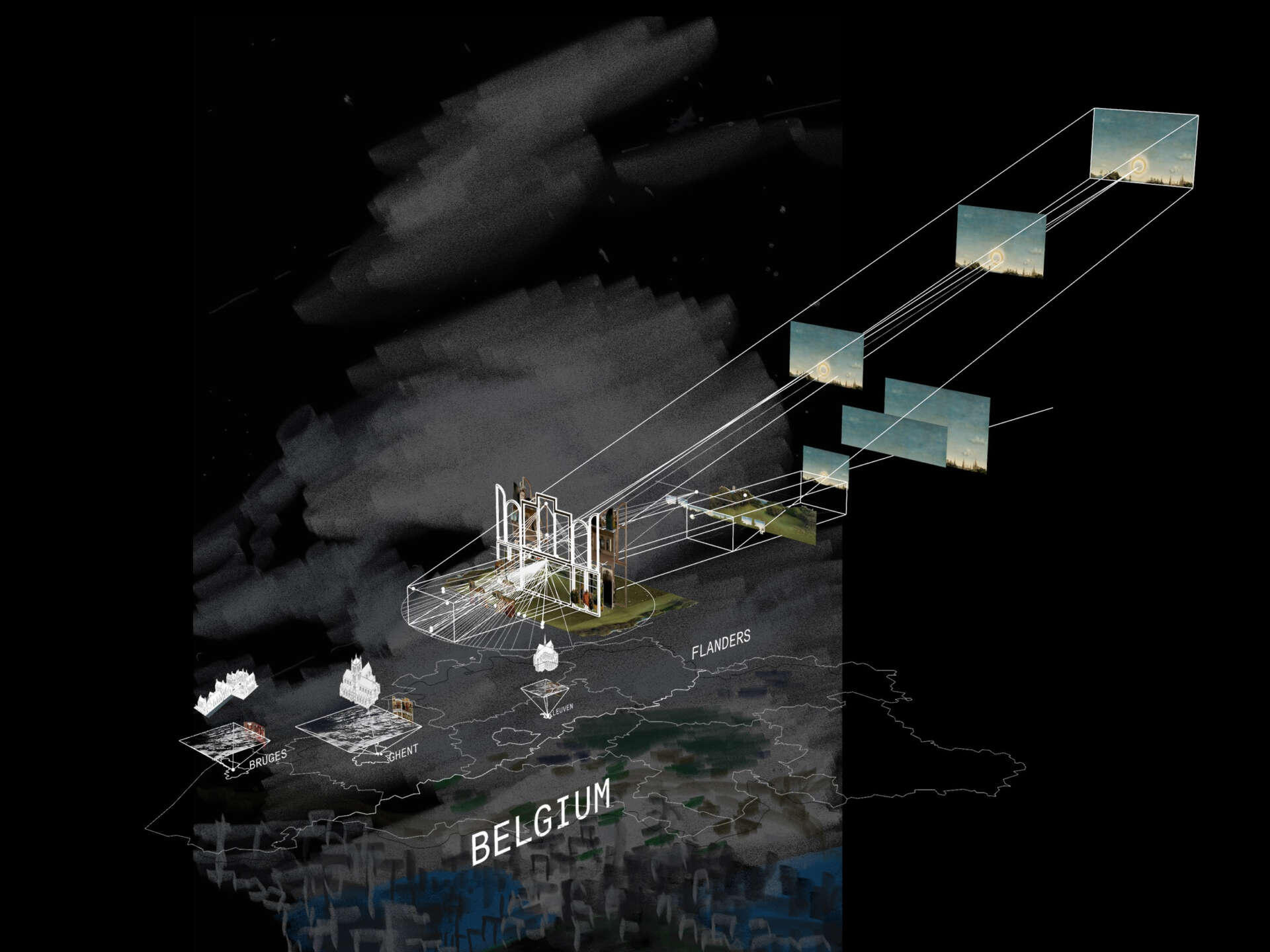
Figure 5: Flemish Sky Imaginaries. Drawing by Alma Grossen, 2026.
The Laplacian Pyramid removes the body as relational center, whereas the altarpiece’s reverse perspective includes it by creating a non-hierarchical field. These two perspectival logics applied to the same sky above Sint Baafsplein are irreconcilable.
As a method for situated practice, the stitching of 33 situated viewpoints on Sint Baafsplein, by creating overlapping panorama images of the sky in all cardinal directions, the viewpoint of the specific perspective is placed behind the image. The multitudes of perspectives looking back create a counter-map the sky over the square, encoding the nonscalable relational field against the orthographic territorial gaze. The model is built in the Hyperfield model and subsequently translated into a physical model revealing the scalar break. (Fig. 6)
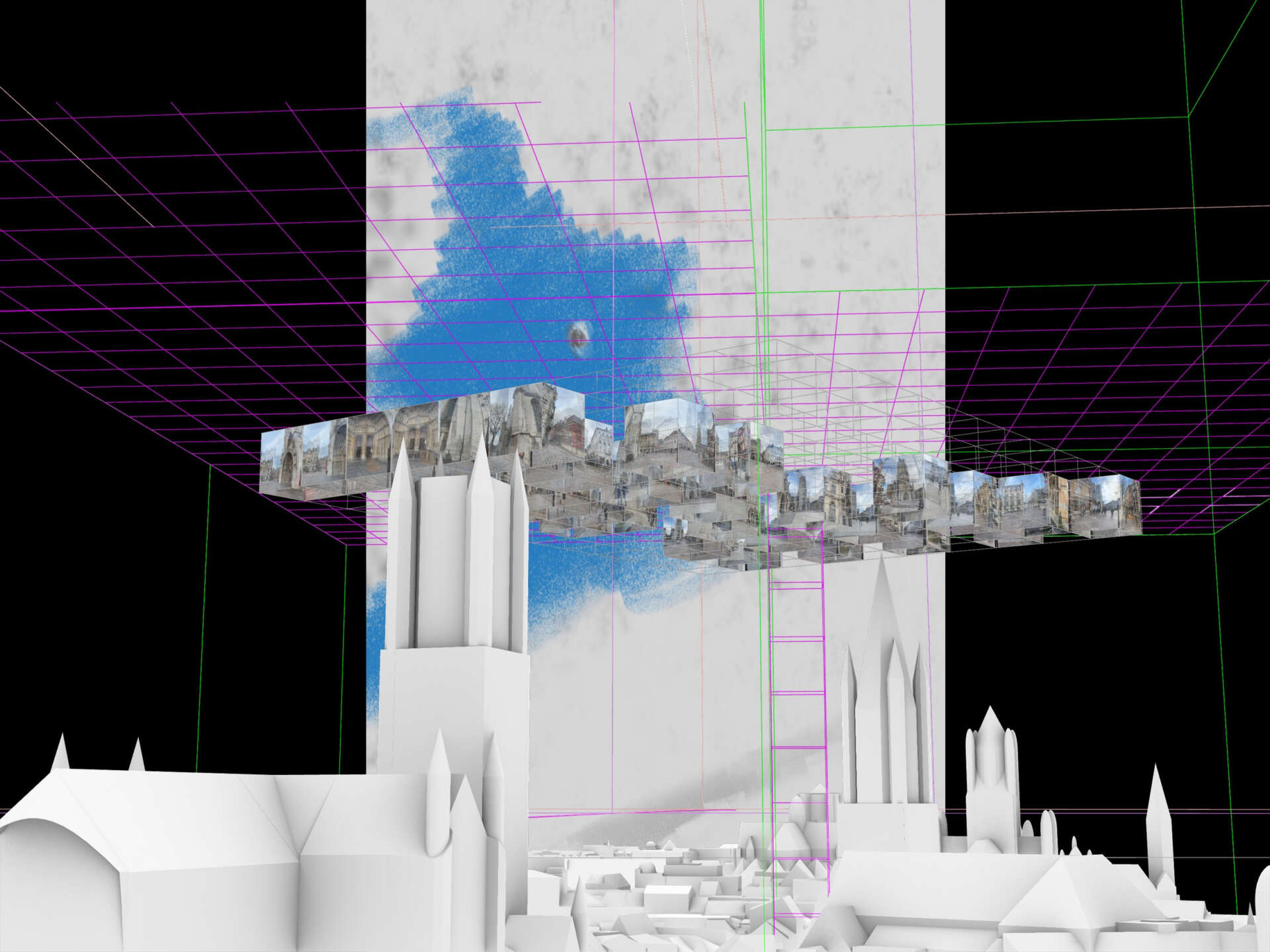
Figure 6: Sky Inversion. Drawing by Alma Grossen, 2026.
Conclusion
Each Sky Inversion produces a method for situated practice, that accumulated, reveal the sky as an encountered form body scale and ground level, assembled through the practice of the developed situated practices located within the Hyperfield, building a critical cartography from the ground up. It is not a pre-existing condition, but a dynamic one produced through theoretical readings decoded through architectural drawings, and countermappings revealing the scalar breaks between atmospheric datafication and shifting collective sky imaginary.
This research produces a critical field atlas leading through the Hyperfield, for reading the sky simultaneously as metaphor and territory. The Lexicon is the portable, repeatable form of the Hyperfield, holding the scalar tensions within to build a critical spatial model of the sky.
The contribution of this research to the field of architecture is epistemological rather than instrumental. It demonstrates that architectural drawing can function as a critical research instrument for decoding the scalar politics embedded within media systems and that the field guide is formed through situated encounter. The Sky Lexicon is not a design manual, rather a method for reading the sky as irreconcilable hyperobject and nonscalable shared space we inhabit.
Literature
(99+) The Composition of the Ghent Altarpiece (Divine and Human Perspectives) (no date). Available at: https://www.academia.edu/61528... (Accessed: 11 March 2026).
Adey, P. (2014) Air: Nature and Culture. London: Reaktion Books (Reaktion Books - Earth).
Avermaete, T. and Sabatino, M. (2025) The global turn: six journeys of architecture and the city, 1945-1989. Rotterdam: nai010 publishers.
Barrio, R.S. (2023) ‘Reimaging Earth. Architecture and the critical and speculative uses of geovisualization’, City, Territory and Architecture, 10(1), pp. 1–16. Available at: https://doi.org/10.1186/s40410....
Brenner, N. (2001) ‘The limits to scale? Methodological reflections on scalar structuration’, Progress in Human Geography, 25(4), pp. 591–614. Available at: https://doi.org/10.1191/030913....
Brenner, N. (ed.) (2017) Implosions - explosions: towards a study of planetary urbanization. Berlin: Jovis.
Callard, A. (2018) Aspiration: the agency of becoming. New York, NY: Oxford University Press. Available at: https://doi.org/10.1093/oso/97....
Crampton, J.W. and Krygier, J. (2015) ‘An Introduction to Critical Cartography’, ACME: An International Journal for Critical Geographies, pp. 11-33 Pages. Available at: https://doi.org/10.14288/ACME.....
Grosz, E. (ed.) (2001) Architecture from the outside: essays on virtual and real space. Cambridge, Mass: MIT Press (Writing architecture series).
Haraway, D. (1988) ‘Situated Knowledges: The Science Question in Feminism and the Privilege of Partial Perspective’, Feminist Studies, 14(3), p. 575. Available at: https://doi.org/10.2307/317806....
Harman, G. (2011) The quadruple object. Winchester: Zero books.
Hockney, D. (2006) Secret knowledge: rediscovering the lost techniques of the old masters. 2. Aufl. London: Thames & Hudson.
Horn, E. (2018) ‘Air as Medium’, Grey Room, 73, pp. 6–25. Available at: https://doi.org/10.1162/grey_a....
Ingold, T. (2008) Lines: a brief history. Repr. London: Routledge.
Iwaniszewski, S. (2011) ‘The sky as a social field’, Proceedings of the International Astronomical Union, 7(S278), pp. 30–37. Available at: https://doi.org/10.1017/S17439....
Just, J.F. (2024) ‘Multispecies Walking: Ways of Knowing and Researching Landscapes with Experts’. ETH Zurich. Available at: https://doi.org/10.3929/ETHZ-B....
Koenderink, J.J. (1984) ‘The structure of images’, Biological Cybernetics, 50(5), pp. 363–370. Available at: https://doi.org/10.1007/BF0033....
Kurgan, L. (2013) Close Up at a Distance: Mapping, Technology, and Politics. Zone Books. Available at: https://doi.org/10.2307/j.ctt1....
Lindeberg, T. (1994) Scale-Space Theory in Computer Vision. Boston, MA: Springer US. Available at: https://doi.org/10.1007/978-1-....
May, J. (2017) ‘Everything Is Already an Image’, Log, (40), pp. 9–26.
Morton, T. (2013) Hyperobjects: philosophy and ecology after the end of the world. Minneapolis: University of Minnesota Press. Available at: https://kuleuven.limo.libis.be....
Panofsky, E. and Panofsky, E. (1991) Perspective as symbolic form. 3. print. New York: Zone Books.
Parks, L. (2013) ‘Mapping Orbit: Toward a Vertical Public Space’, in: C. Berry, J. Harbord, and R. Moore (eds) Public Space, Media Space. London: Palgrave Macmillan UK, pp. 61–87. Available at: https://doi.org/10.1057/978113....
Peters, J.D. (2015) The marvelous clouds: toward a philosophy of elemental media. Chicago ; London: the University of Chicago Press.
R. Buckminster Fuller (2008) Operating Manual for Spaceship Earth. Available at: http://archive.org/details/buc... (Accessed: 24 July 2025).
Taffel, S. (2013) ‘Scalar entanglement in digital media ecologies’. Available at: https://doi.org/10.25969/MEDIA....
Tsing, A.L. (2012) ‘On Nonscalability’, Common Knowledge, 18(3), pp. 505–524. Available at: https://doi.org/10.1215/096175....
Vegetti, M. (2017) L’invenzione del globo: spazio, potere, comunicazione nell’epoca dell’aria. Torino: Einaudi.
Weizman, E. (no date) The Politics of Verticality. Available at: https://www.opendemocracy.net/....